
UPDATE: An additional Mapathon will take place on Friday 22nd 2013 from 11.00 onwards in the lecture hall of the Department of Geography, Berliner Str. 48, Heidelberg University.
CrisisMapping by volunteers is on the rise and and an more and more important contribution to professional disaster management. This has also been confirmed within our conference on social media in disaster management a month ago.
For example the number of volunteer contributors to OpenStreetMap adding data to the Philipines after Typhoon Haiyan has passed the mark of 1.000 OSM crisismappers already after only one week! Let’s compare this with the biggest OSM crisis mapping event so far: this was the earthquake in Haiti 2010 and there even after a month the number didn’t pass 700. This shows that the potential of OSM crisis mapping is ever increasing. More importantly also the coordination with professional organisations in disaster management and humanitarian aid from red cross to the UN is much better nowadays. This assures that the data generated is actually being used for the intended purpose. Still the crisis mappers relay on the availability of high resolution satellite imagery – in particular post disaster imagery. The availability of such sources and the speed of making such imagery available to the OSM crisis mappers community still needs to be enhanced.
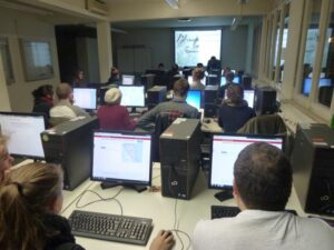
On Thursday Nov. 14th Andreas Reimer together with collegues from the GIScience Group organized a Mapathon to support crisis mapping in OpenStreetMap after Typhoon Haiyan. First a theoretical introduction into crisis mapping in general and OSM in particular for the students of the introductionary courses in Cartography and Geoinformatics at the Department of Geography and further interested persons was given by Andreas, Pascal, Svend and Joao. This also included a live video introduction to the relevant tasks to be performed by the OSM H.O.T main coordinator for the Haiyan disaster Andrew Buck. Thanks for joining us from remote!
More than 200 geography students at the Department of Geography of Heidelberg University will be editing OSM maps according to H.O.T tasks at least over the next week being supervised by members of the GIScience group. Several individual groups fitting into the computer room at the Department of Geography will be active at different times. So this will continue the mapathon for over a whole week and hopefully beyond. We are looking forward to the results of these accomplishments. Thanks to all organizers and helping hands.


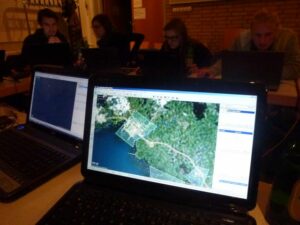
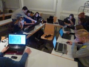
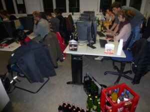
After the introductionary lessons on Thursday over 40 volunteers were participating in an open mapathon until late in the evening. Because of the limited space available the mapathon spread into smaller groups of contributors into the pc pool as well as the larger lecture hall at the Department of Geography of Heidelberg University.
Some results (e.g. damaged buildings or “elements at risk”) can be seen at the http://crisismap.geog.uni-heidelberg.de
Leave a Reply
You must be logged in to post a comment.