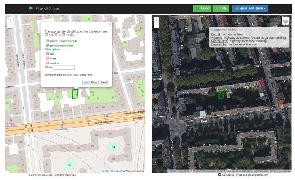
The increased development of Volunteered Geographic Information (VGI) and its potential role in GIScience studies raises questions about the resulting data quality. Several studies address VGI quality from various perspectives like completeness, positional accuracy, consistency, etc. They mostly have consensus on the heterogeneity of data quality. The problem may be due to the lack of standard procedures for data collection and absence of quality control feedback for voluntary participants. In our research, we are concerned with data quality from the classification perspective. Particularly in VGI-mapping projects, the limited expertise of participants and the non-strict definition of geographic features lead to conceptual overlapping classes, where an entity could plausibly belong to multiple classes, e.g., lake or pond, park or garden, marsh or swamp, etc. Usually, quantitative and/or qualitative characteristics exist that distinguish between classes. Nevertheless, these characteristics might not be recognizable for non-expert participants. In previous work, we developed the rule-guided classification approach that guides participants to the most appropriate classes. As exemplification, we tackle the conceptual overlapping of some grass-related classes. For a given data set, our approach presents the most highly recommended classes for each entity. In a recently published paper, we present the validation of our approach. We implement a web-based application called Grass&Green that presents recommendations for crowdsourcing validation. The findings show the applicability of the proposed approach. In four months, the application attracted 212 participants from more than 35 countries who checked 2,865 entities. The results indicate that 89% of the contributions fully/partially agree with our recommendations. We then carried out a detailed analysis that demonstrates the potential of this enhanced data classification. This research encourages the development of customized applications that target a particular geographic feature.
Ali, A.L.; Sirilertworakul, N.; Zipf, A.; Mobasheri, A. (2016): Guided Classification System for Conceptual Overlapping Classes in OpenStreetMap. ISPRS Int. Journal of Geo-Information 2016, 5, 87.